Railway Stations and Stations of the Destroyed Section of Tuapse

The fate of the Tuapse station buildings on the Staromaryevskaya -
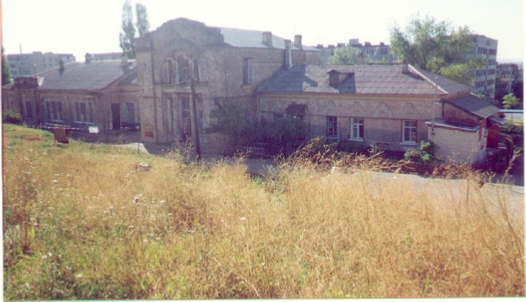
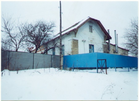
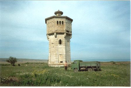
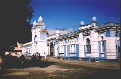
Station Stavropol
This half-
The other turned out to be far from the resorts and traffic flows. It did not stay for long as a train station, quickly lost its decorative turrets on the roof, and became a quiet, almost abandoned, residential building in a remote city outskirts, hundreds of kilometers from the sea and large traffic flows. An ignorant passer-
There is, however, something in common in their fate. Both buildings were built for the railway, but did not last long in the railway service. In 1923, the Tuapse -
Station duty station: This building stood at the southern mouth of the station. Apparently, there were switchmen in it, and from it the input semaphore was switched from the side of Armavir. Now it is an extension to a private house on the street. Lenin.
The architecture of this booth, as well as the next two stations, was standard for the entire Tuapse. It reveals a Western European style that is unusual for these places. A photograph of exactly the same booth at the 211 km crossing of the Armavir -
Station duty station
station in Petrovsky (Svetlograd)
Station duty station

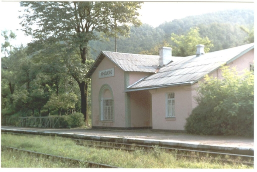
Khadyzhenskaya station
Building on Mamaika
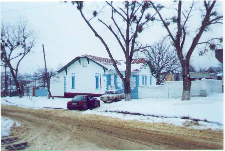
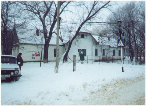
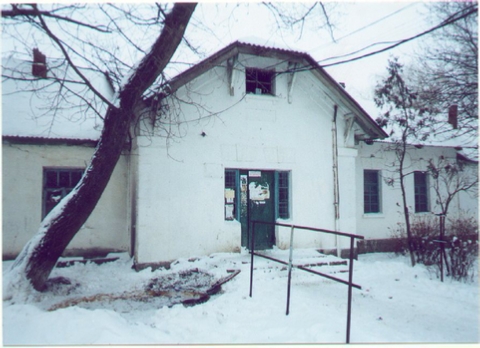
This building is located in the south of Stavropol, on the northern slope of the Mamayka gully in front of the Small German Bridge . It is possible that in reality this building was not a railway station, but was a base for the railway workers, but it was built according to the same project as some other stations and buildings on this road in the style standard for the Armaviro-
At the moment, the building is a church ("house of prayer") of one of the Christian sects.
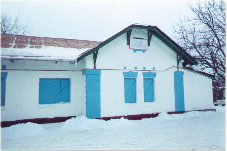
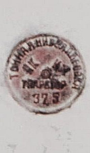
This is what this building looks like now. A cast iron plaque on the east wall of the station building (it is also visible above in the right photo, to the right of the right window). The plate reads "Accurate leveling" (original spelling).
According to employees of the Stavropol Regional History Museum, the plaque was put up at the beginning of the century by the insurance company "Salamandra" as a sign that the building was insured against fire. JSC Engineer Pertsov (JSC Armavir-
More probable, however, is the version about the post-
Station Ozernaya
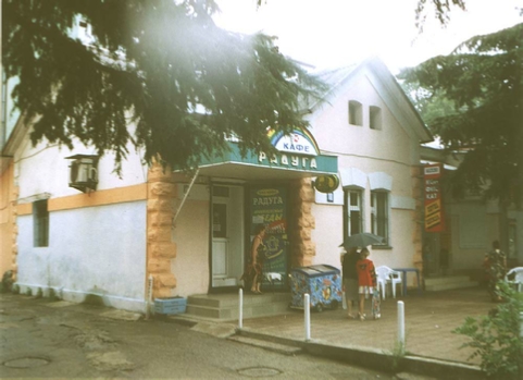
Apparently, this was the name of this station located in the village of Demino. The station was built according to the same design as the building in the previous photographs, but in general it is worse preserved. The layout inside was completely changed, a door was made in the facade instead of two windows, and annexes were built. This is what this building looks like now. At the moment, the premises of the village utilities are located in the station building.
Surprisingly, exactly the same buildings as this, or in the photo above, have survived on the main street in Tuapse -
Station Ozernaya
Station Ozernaya
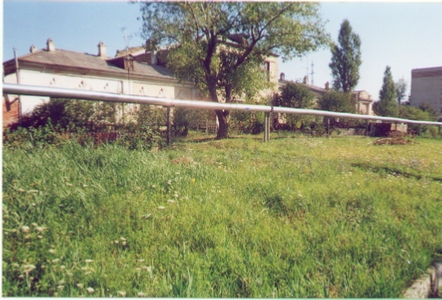
former auxiliary station buildings

former auxiliary station buildings
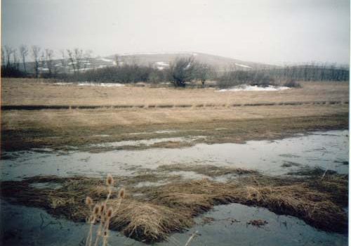
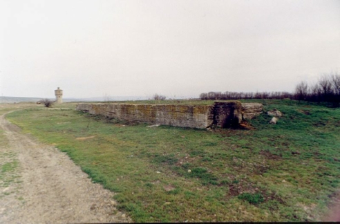
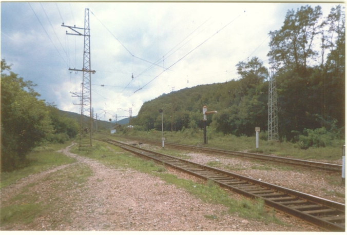
Station in the Yegorlyk Valley
We do not yet know what it was called, "Darkoleskaya" or "Sengilevskaya". It is these points that are marked in this area on the 1916 railway map. Another possible name for it is "Nedlemnaya" or "Tatarka" (see in more detail the section "Where were the stations on the Staromaryevskaya -
The area around the buildings was leveled. This means that the station may have had (should have?) Track development.
In the same place, there is a fork in the two routes of Tuapsinka through Yegorlyk: along the high Novokavkazsky bridge, and along a small bridge downstream. It is not known exactly why 2 routes were made. So far, there are only different versions .
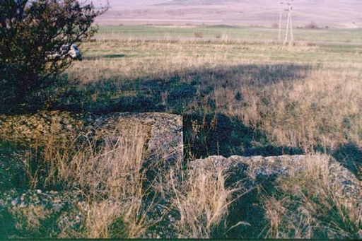
Remains of the foundation of the station building.
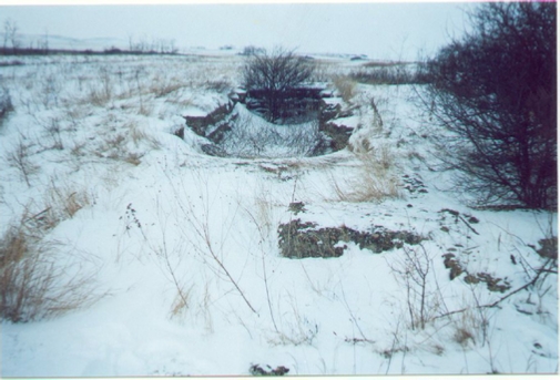
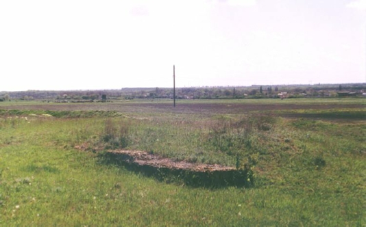
Station near the village of Nadzorny
The name of this station is also not known yet. Perhaps it was "Nesleep" or "Sengilevskaya". This puzzle is described in more detail in the section "Where were the stations on the Staromaryevskaya -
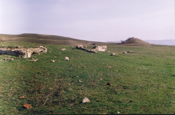
Station Nikolaevskaya
This is the best preserved station on the Stavropol-
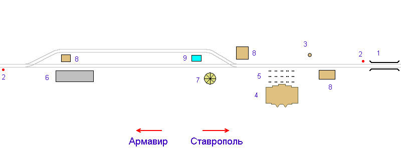
Below is a diagram of the location of objects at the station according to Denis Morozov. There were probably more tracks at the station. Only those that are guaranteed to exist are shown. The scale and proportions in the diagram are not respected.
Objects on the diagram:
1. Nikolaevsky bridge .
2. Supports of station input semaphores.
3. Well.
4. Station foundation.
5. Passenger platform foundation. The platform itself was wooden and has not survived.
6. Cargo platform.
7. Water tower.
8. Foundations of other buildings.
9. Pool. Possibly built after the closure of the station for the farm.
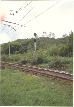
Support of the warning disk in front of the entrance semaphore to the station from the side of Stavropol. The disk stood in front of the Nikolaevsky bridge, therefore it is not shown in the diagram. Supports of input semaphores from Armavir (left) and Stavropol. The embankment to Armavir leaving the station is clearly visible. View of the station from the side of the Stavropol mouth. The foundations of the station are visible on the left. Between it and the tree are the supports of a wooden passenger platform. In the center is a water tower, to the right is the foundation of one of the buildings. Further to the right is a swimming pool and an agricultural farm, built much later than the road was closed. Cargo platform. It is not known whether it was used for loading cargo or refueling steam locomotives. It is also possible that this is, in fact, also the foundation of the building. Water tower for refueling steam locomotives. The tower is cast from monolithic concrete. Apparently, for this reason, it was not dismantled like other buildings into stones, and has survived to this day in its original form. Station foundation.
The drawing on the plaster of the foundation matches the drawing on the plaster of the water tower. Apparently, the tower and the foundation were designed in the same architectural style. This is also evidenced by the unusual shape of the building's perimeter (see above the diagram of the station). Plaster on another large station building had the same pattern. The foundation of the switchmen's booth in the Armavir mouth of the station.
Station Derzhavnaya
Located north of x. Sovereign . The only place where this station is mentioned is the article by A.A. Vlasov on the armored trains of the Volunteer Army (see this excerpt).
Unknown stations of the Staromaryevskaya -
Some of the stations mentioned in different sources are the Ula, the Bazny and Ubezhenskaya junction. For the names "Sengilevskaya", "Temnolesskaya", "Nedremennaya" and "Tatarka" it is also not known to which of the found (or not yet found) stations they belonged.
In the section "Where were the stations on the Staromaryevskaya -
Stations of the Khadyzhenskaya -
This section of Tuapse is located in the mountains. During the Second World War, fierce battles took place here. Apparently, it is for this reason that not a single station building has survived at the stations. Instead of the Armavir -
Khadyzhenskaya station
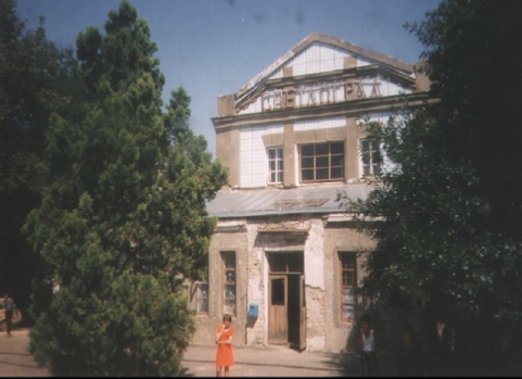
The name of the station comes from the village of Khadyzhenskaya (now Khadyzhensk ), located at the confluence of the river Khadazhki into Pshish. However, the station and the railway station are not located in Khadyzhensk itself, but in the village of Stantsnoye, which owes its birth to the railway station.
There is a legend that according to the initial project, Tuapse was supposed to pass through Khadyzhenskaya along the banks of the Pshish. A railway station was to be built in the center of the village. However, the Khadizha residents categorically refused to sell their lands to the Armavir-
The first station building was apparently destroyed during the Great Patriotic War. The modern building was built on its foundations. The architecture of the modern station building does not differ much from the Tuapseinki station in Armavir . It also has exactly the same facades from the paths and the station square. The Armavir neck of the Khadyzhenskaya station rests against the portal of the Khadyzhen tunnel . At the station, there are still working traffic lights and a locomotive pump.
A very interesting building of clearly Western European architecture is on the right in the photo of the first Khadyzhensky railway station. Almost exactly the same buildings have survived in Stavropol , at the site of the dismantled section of Tuapse, and in the village of Demino near Stavropol ! Obviously, this was the standard architecture of ancillary buildings on the Armavir-
In the photos: The first building of the Khadyzhensk railway station, the modern railway station, the Tuapse neck of the station and the entrance traffic light at the portal of the Khadyzhensky tunnel.

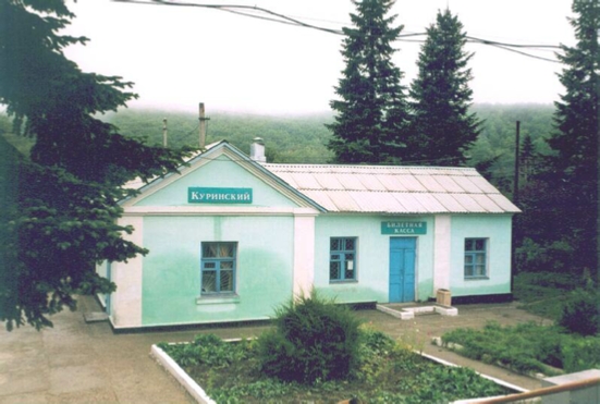
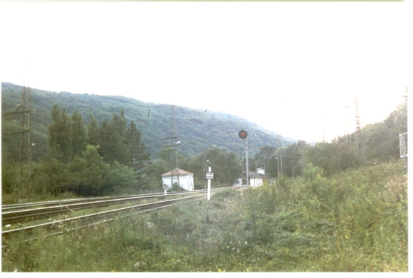
Departure Kurinsky
The name of the crossing comes from the name of the village of Kurinskaya, located in the Pshish valley. The station building in the photo was built, as you can see, after World War II. Obviously, the previous building, like many others on Tuapse, was destroyed in heavy battles that took place here. The station is interesting in that it has a reversal triangle for steam locomotives!
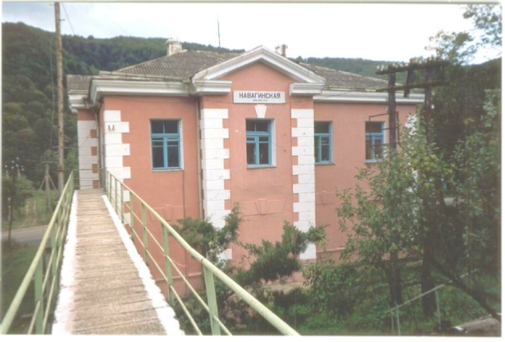
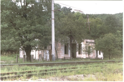
Station Navaginskaya
This station, like the village of Navaginskaya, got its name from the Navaginsky infantry regiment, which founded a post here in 1864.
The railway station is located on a steep slope of the gorge, Pshish. It is for this reason that the station building has been made two-
The abandoned building in the photo on the right could also have been the former train station building or the guardhouse for the bridge and tunnel. The photo below shows the Tuapse throat of the station and output floodlights.
Station Pshish
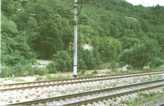
This station is located in the Pshish bend, in the very place where the Tuapsinka crosses the river twice on high bridges, thus cutting off the loop of the bend. During the construction of the railway, an unnamed construction community of Tuapsinki, later named Oktyabrsky, arose around the station.
The station pavilion in the photo is post-
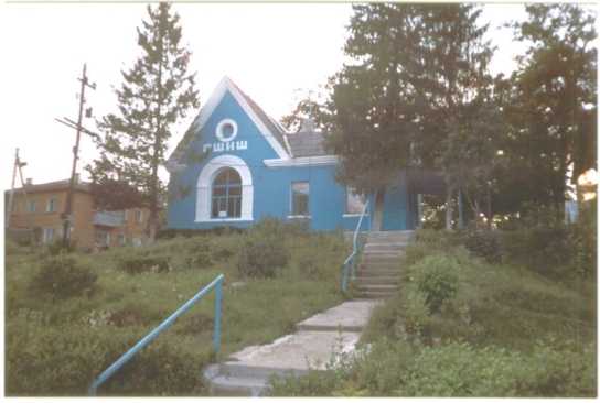
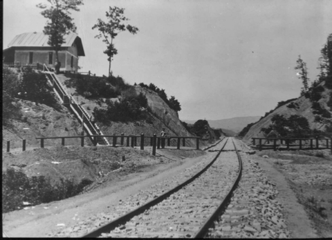
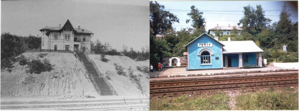
Goyth Station
The station is located in a deep cut on the northern slope of the Main Caucasian ridge north of the Goytkh pass. Its name, translated from the Adyghe language, means according to one of the versions "a ridge with a thorny bush". Thorny blackberry bushes with juicy berries still grow in large numbers on the embankments of Tuapse and open areas of the mountain slopes in this area.
The building in the photograph from the beginning of the century stood at the edge of the recess. At the moment it does not exist, nor does the staircase leading to it from the paths. The author of the site could not even find any traces of these structures.
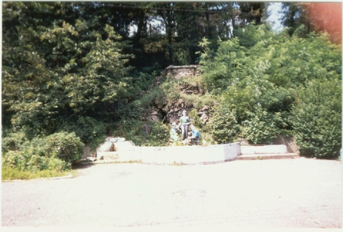
The sculptural composition on the platform is actually a small waterfall. Obviously, after the construction of the station, the mountain stream began to fall directly onto the platform, which is why it was turned into a decorative fountain.
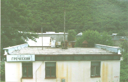
Departure Greek
The exit is located in a very picturesque place: here the Tuapse valley narrows a lot, and there was barely enough space for the paths. As you can see in the photo on the left, in some places the cliff into the seething water stream starts almost from the edges of the sleepers! The station building itself, as you can see, has no architectural value. Tuapse in the Tuapse valley was almost completely destroyed by German aircraft in 1942-
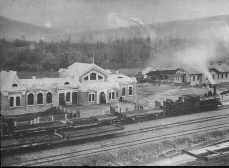
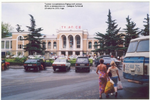
Stations in Tuapse
The photographs below of the Tuapse station of Armavir-
Turkey station
The station is located in the valley of the Turkey River immediately after leaving the Loop . The name of the station comes from the name of Mount Indyuk located in the area. There are many versions regarding the origin of the name of the mountain, but they all look for the roots of this word in the ancient Adyghe languages. The Armavir mouth of the station abuts against the Tuapse portal of the Big Loop Tunnel .
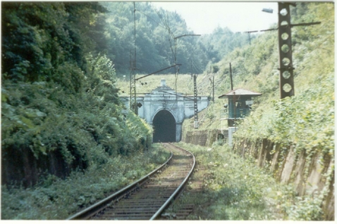
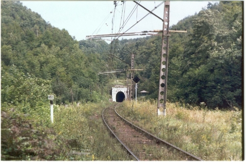
Both Ends of the Goyth Tunnel of Tuapse
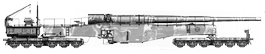
It is known that as a result of prolonged bombing,The Goyth tunnel was completely blocked up in three places, andGoyth station , which was defended by an armored train, was completely wiped off the face of the earth. However, the Germans did not manage to cross the pass that began behind the station, and reach the other end of the "lair" of the Steel Dragon, whose actions undoubtedly played an important role in the success of the Tuapse defensive operation.