
Mysteries of Tuapse History

The material presented on the site, of course, cannot pretend to be complete. There are many questions, the answers to which are not yet known to the creators of this site . However, the matter does not stand still, new questions appear and new versions and answers to old ones are found.
Construction narrow-
At the beginning of the 20th century, road transport was quite expensive to operate, and did not yet allow transporting large masses of goods. Therefore, for the construction of large facilities, such as railways, temporary narrow-
Usually, temporary narrow-
On the website of the Hotel Molniya, in the description of the excursion to Mount Indyuk, such a narrow-
Signs of an existing, possibly temporary, narrow-
When was the Palagiada -
This site contains a version according to which 2 independent and competing companies built 2 railways with two stations through Stavropol. The first was the JSC of the Vladikavkaz railway, which built the Stavropol-
At the same time, in the author's abstract of the dissertation of Yu. G. Kharin it is mentioned that in the same 1916 the JSC of the Vladikavkaz railway opened the Palagiada -
Not everything is clear with the opening date of the Petrovskoe -
So far, the most likely version is the version set forth on this site that the entire Stavropol -
Where were the stations on the Staromaryevskaya -
For a steam locomotive, overcoming a track with a very heavy profile, more than 100 versts long between Stavropol and Armavir, was a difficult task. It was necessary to replenish supplies of fuel and water on the way. In addition, the road passed through several villages and stanitsas, which were potential sources of not only passengers, but also agricultural goods. Obviously, there should have been stations on this section of Tuapsinki.
And there were such stations. They are marked on the map of Tuapse in 1916 and described in the comments to it. These are "Ubezhenskaya", "Nikolaevskaya", "Sengilevskaya", "Temnoleskaya", as well as "Ula" between Stavropol and Staromaryevskaya.
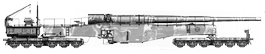
The articles by A.A. Vlasov, the stations "Ubezhenskaya", "Derzhavnaya", "Nedremennaya", "Tatarka" and the siding "Bazny" are also mentioned about the armored trains of the Volunteer Army, located on the road in the listed order. The relevant excerpts from these materials are given in the section "The Civil War in Tuapse" .
But where could they be? "Ula" (or "Chla"?) Could be located northeast of Stavropol. But no traces have yet been found there.
Station buildings have been preserved in the southern part of Stavropol and in the village. Demino . One of them, apparently, was the Ozernaya station. Or "Darkwood".
Traces of some kind of foundation remained in Upper Tatarka on the slope of Stavropol Mountain and Tatarka gully. However, at this point, the foundation is too far from the embankment.
There is also a strange fork in the embankments for the tracks in Nizhnaya Tatarka. But one of the ways was a dead end, the neck was from the side of Stavropol. Apparently, the Tatarka station was in one of these places. In Upper Tatarka, there could also be "Temnoleskaya".
A relatively convenient place for arranging a crossing can be called a hollow between the mountains north of x. Verkhnegorlyksky. But no traces have yet been found there.
The next convenient place is on the other bank of the Yegorlyk, and there really are foundations of two buildings, the area around which was probably an artificially leveled area (for laying tracks?). Logically, there could be "Tatarka" (the only intelligible station found near the village), "Nedremennaya" (as it stands near Nedremennaya mountains), "Temnoleskaya" or even "Sengilevskaya" (along Yegorlyk there could be roads to the villages of Temnolesskaya and Sengileevskaya) ...
Remains of the foundations of the station structures are also found on the southern slope of the Nedremenny ridge near the village of Nadzorny. (Maybe "Sengilevskaya" is it here?).
A full-
Found also a foundation in the area x. Sovereign . Obviously, this is the "Sovereign" mentioned by Vlasov.
The situation with the Bazny junction is more unclear. In the description of the battle and the death of an armored train on this siding in the article by A.A. Vlasov it is mentioned that he was between Stavropol and s. Tatarka, at the exit from it in the direction of Stavropol there was a notch, and on the right (along the train?) There was a valley. Only one place fits this description -
Mysteries of the Novokavkazsky bridge
On the way from Stavropol to Armavir, the road had to go down along the slopes from the Stavropol Mountain, cross the Yegorlyk valley, and again climb the slopes of the Nedremenny ridge in order to cross it. The high Novokavkazsky bridge was built, apparently, in order to minimize the height differences between the sections of the road on these slopes and in the Yegorlyk valley.
But to the west of Novokavkazsky there was another bridge across Yegorlyk, possibly unfinished or destroyed (see map ). There are also neat flat embankments leading to Tuapsinka, the railway purpose of which is beyond doubt.
Perhaps it was a construction track road. Such roads have always been built before the start of the construction of the railway line. Such a road went along Tuapseinki.
It is also possible that a narrow-
It can also be assumed that this was a temporary route of the main railway, since the construction of the Novokavkazsky bridge and high embankments required a large amount of work with a relative distance from the nearest sources of building stone and the absence of roads well suited for transporting large loads. The first trains had to overcome steep descents and ascents in the Yegorlyk valley, until the main route was put into operation, through the Novokavkazsky bridge.
This version is also supported by the embankments that are too low at the present time at the Novokavkazsky Bridge. Maybe they were not completed? The missing span of the bridge itself may have never existed either, since no debris can be seen underneath. Some Tatarka residents also say that the road was not completed, although trains did run along it.
There is another version: the Novokavkazsky bridge and the embankments to it were nevertheless built and operated. The bridge was blown up in the civil war, after which a temporary road route was built (possibly using the remnants of the Novokavkazsky bridge). Even the Germans in the 40s could do this (see "Tuapse during the German occupation" ). And the embankments just swam over time.
The question also arises, where did these 2 branches diverge and where did they merge? Where was the fork on the north side, i.e. from the side of Tatarka is not yet known. Numerous landslides over the past decades have greatly distorted the area and destroyed in many places the traces of Tuapse. Most likely, it was behind the Small Novokavkazsky Bridge . But it could be closer to Tatarka. On the southern side of the valley, the location of the fork is well marked -
Another mystery -
The last train, the passage of which from Armavir to Stavropol is reliably known, was the armored train of the Volunteer Army "Sea Battery No. 2" . In the period from September 13 to October 14, 1918, he retreated under the onslaught of the Taman army from Armavir to Stavropol, where his base was located and where he regularly traveled to supply water and fuel. Probably during these battles by the Tamans, who, most likely, did not have armored trains, the Novokavkazsky bridge was blown up.
The bridge could also have been blown up at the end of October 1918 during the attack on Stavropol by the troops of General Wrangel. From Armavir he was supported by the armored trains "United Russia" and "1st Armored Train" . However, these armored trains did not take part in the storming of Stavropol, although they were urgently needed there. Is it because of the destroyed Novokavkazsky bridge?
Theoretically, the bridge could have been destroyed in 1920, during the retreat of the whites. But armored trains in those years, apparently, were not used in the region of Stavropol by either side, and therefore it made no sense to blow up a railway bridge across a small river.
Did the Germans restore Tuapse during the occupation of Stavropol in 1942-
On the map of Stavropol, compiled by the Germans during the occupation , the dismantled Tuapsinka and the connecting branch between the stations are marked in the same way as the existing Stavropol -
However, there is also such information that in the 40s the road was indeed partially restored in Stavropol. Precisely by the German occupation authorities. And the German map was, therefore, not far from the truth, and reflected, if not the present, then the imminent future, in the opinion of the occupation authorities.
Unfortunately, we still do not know what sections of the road and for what purposes were restored in those years.